Texas Realities

NOAA satellite image from June 13, 2023, 1:16 pm local time. South-East Texas has nice cloud streets running up from the coast. Thunderstorms are shading off Central Texas, but South and West Texas are exactly as we’ve experienced it: blue skies with not much thermals.
The problem with coming here is that conditions rarely line up. And if they don’t, you’re stuck in the “armpit of Texas”, as Larry Tudor (hang glider legend) told us.
The flying so far has been underwhelming. Days start out overcast. The cloud cover has been braking up before noon. We launch with low cloud base, barely staying aloft in meek thermals blocked by an inversion at 1000 m. By noon the sky is blue, thermals turn off, and even Benz & Timo bomb out. The weather forecast looks like more of the same.


More of the same stable soup ahead. Meteoblue’s meteogram (left) shows low clouds forming at night, evaporating before noon while the wind bleeds off. High cirrus not helping either. Never mind hot and humid. NOAA’s model sounding for South Texas (right) shows a massive temperature inversion at mid day, blocking thermals.
What to do?
Option 1: The radar image shows beautiful cloud streets streaming from the Eastern coast upward. Should we try that? The winds are decent, but cloud base is low, like 900 m. And further north we might hit overdevelopments.
Option 2: Drive 6 hours to Van Horn, in the western tip of Texas. While there doesn’t appear to be much convection there either, at least we’ll get away from the stable air mass smothering South Texas. The forecast predicts strong westerly winds and high cloud base - if there are clouds at all.
All in
We decide for Option 2 and hope for the best. Robin Hamilton thinks it’s worth a try - but no one has gone big along this line before. Time to try. We’ll spend tomorrow driving.
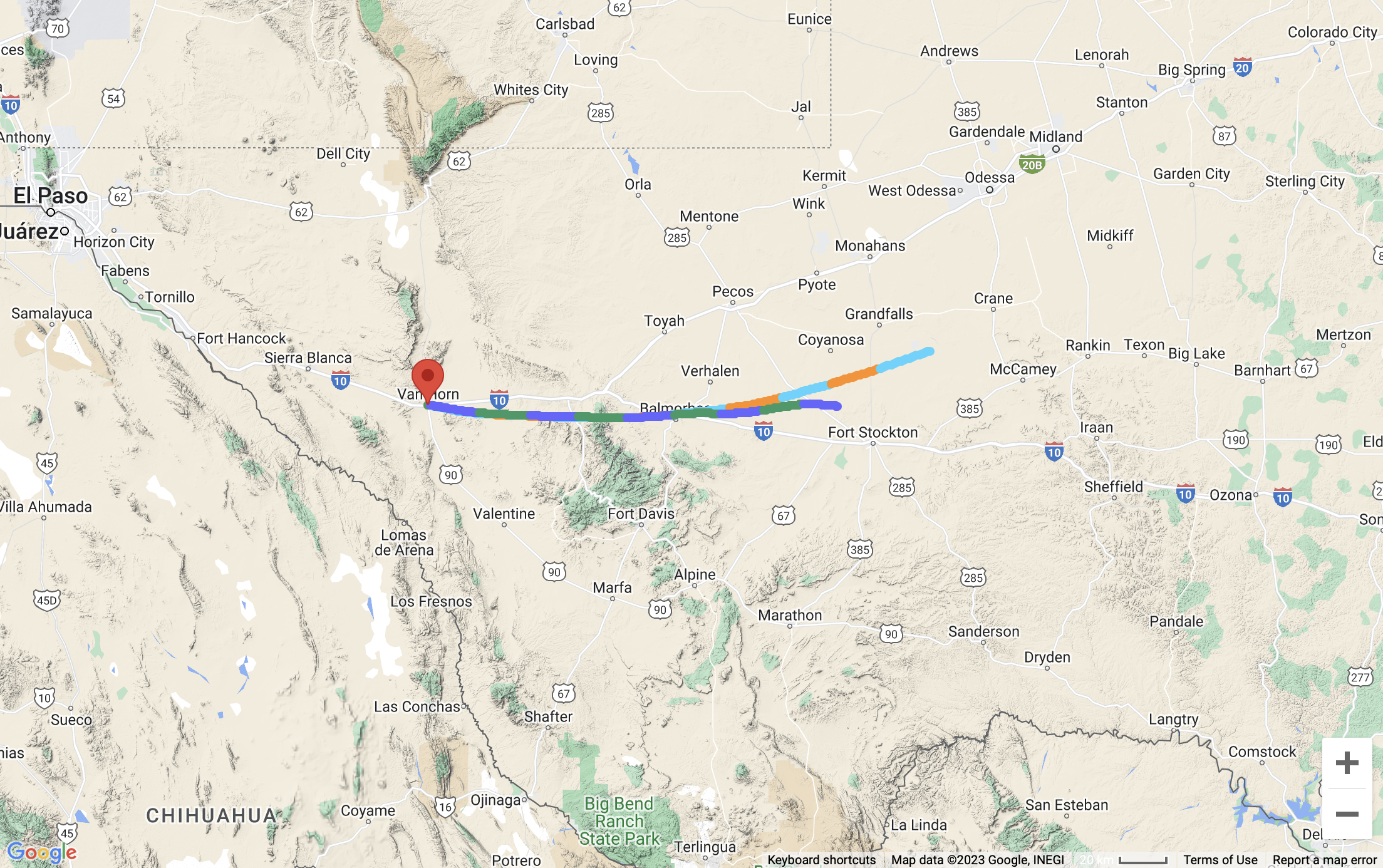
11-hour forward trajectories from Van Horn, TX for Thursday (meteoblue).